top of page



EXCLUSIVE SERVICES
Geo-Mapping

This involves survey and mapping of infrastructure and any other spatial data as per a client's requirements. It also includes collecting and joining attribute data to the spatial data.
Survey & Analysis

This includes but not limited to feedback surveys and analyzing the data to understand customer needs and to study growth dynamics and patterns.
GIS,RS & IT Consultancy

Technical Design

After survey and mapping has been done, I prepare technical design reports again as per the requirements of a client.
Digitization
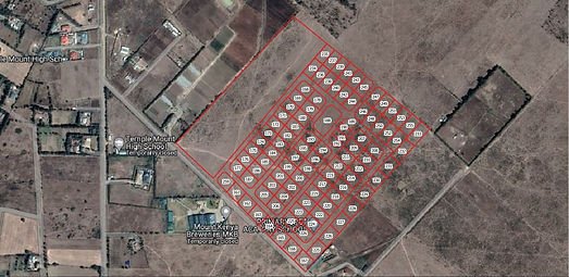
The conversion of maps from analog formats e.g. Registry Index Maps to digital formats which allow querying the data in a timelier manner as well as allowing interactivity.
Gallery


Involves understanding client needs and offering guidance and/or proposing the direction to take depending on the client needs.




bottom of page